A disturbing new video shows 13 years of melt at the Greenland Ice Sheet. The video was stitched together based on NASA and European Space Agency (ESA) satellite data.
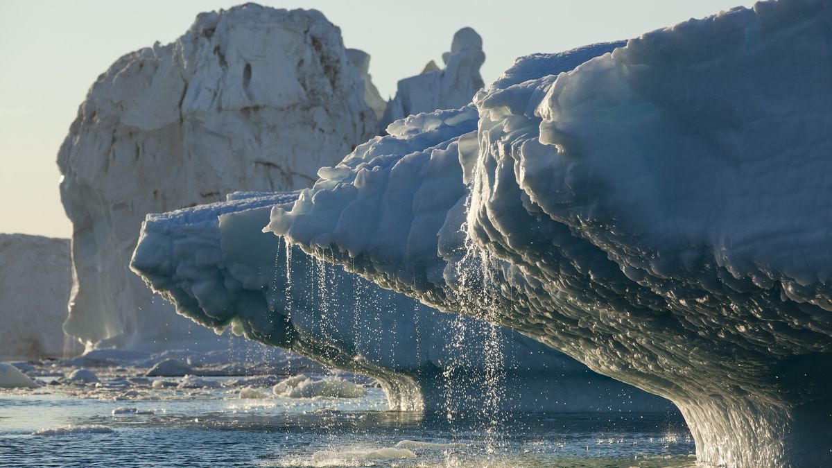
The video reveals how the edges of the ice sheet are melting more rapidly than the center, particularly at spots where glaciers flow into the sea. The new research finds that between 2010 and 2023, Greenland lost 563 cubic miles (2,347 cubic kilometers) of ice, which is enough to fill Lake Victoria, Africa's largest lake. The Greenland Ice Sheet has been losing mass since 1998, according to the National Oceanic and Atmospheric Administration, and it's currently the second-biggest contributor to sea level rise after the expansion of water that occurs due to warming temperatures.
The research, published Dec. 20 in the journal Geophysical Research Letters, wasn't just about quantifying ice loss, though. Both NASA and ESA have satellites keeping a close eye on the region. ESA's CryoSat-2 uses radar to measure the height of Earth's surface, while NASA's ICESat-2 uses laser measurements. Both methods have pros and cons, and researchers wanted to be sure the two measurements returned similar results and could be combined for greater accuracy.
The results showed that they can: CryoSat-2 and ICESat-2 differed by no more than 3% in their estimates of the elevation change on the Greenland Ice Sheet. Their joint results revealed that the ice sheet thinned by an average of 3.9 feet (1.2 meters) over 13 years.
But that average number obscures major differences across the sheet. The ice sheet's edges lost 21 feet (6.4 m), on average. Outlet glaciers saw the worst loss, with a maximum of 246 feet (75 m) at the Zachariae Isstrøm glacier. The worst losses appear in the darkest red in the new video made from the data.
Since 2020, CryoSat-2 and ICESat-2 have been orbiting along the same paths — a joint effort between ESA and NASA to make sure the data collected by both satellites can be simultaneous and synchronized.
"It is great to see that the data from 'sister missions' are providing a consistent picture of the changes going on in Greenland," Thorsten Markus, project scientist for the ICESat-2 mission at NASA, said in a statement. "Understanding the similarities and differences between radar and lidar ice sheet height measurements allows us to fully exploit the complementary nature of those satellite missions."